Losing Control in Teeside with Fiona Erskine
Losing Control in Teeside with Fiona Erskine
A trail with a difference today. Teeside to Bhopal, India!

Fiona:
When I moved to Stockton-on-Tees in 2001, I discovered that Teesside is a wonderful place to live. Affordable housing, great schools and right on the doorstep of the North York Moors, with the Yorkshire Dales and Lake District to the west and Northumbria’s glorious coastline to the North.
Location Map for Losing Control
My first job in the region was based in Hartlepool. I’ve changed jobs several times since then, without ever having to move house or disrupt my family again, although the international travel increased as manufacturing moved east.
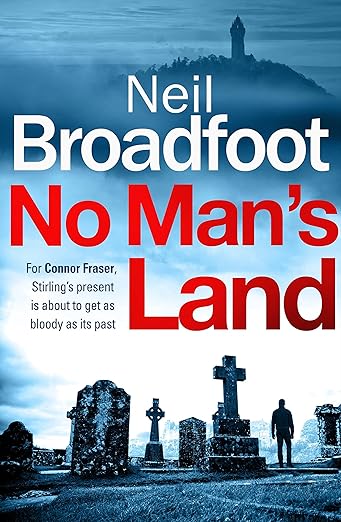
The locations for my 6th novel Losing Control are among my favourite places.
Location Map for Losing Control
The Cleveland Way is a beautiful 109 mile trail that circles the North York Moors. Starting in Helmsley it ends on a beautiful beach at Filey, taking in some of the most interesting and beautiful scenery in England along the way. After his wife dies, Alf Pearce takes solace in walking the coastal part of the trail.
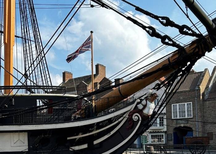
The Hartlepool Historic Quay (c) Fiona Erskine
Location Map for Losing Control
It was my friend Effie Birch who challenged me to include Hartlepool in a novel. Easy-peasy! The Hartlepool Historic Quay houses a magnificent sailing ship, built in India for the Royal Navy, launched in 1817 and the perfect place to link Teesside and India.
RSPB Saltholme (c) Andy Hay, RSPB Images
Location Map for Losing Control
My protagonist, DI Julie Cadell is a tenacious investigator, so when her police colleagues are less than supportive, she seeks outside support. The RSB Saltholme Nature Reserve has a great café right in the heart of Seal Sands (an industrial complex named after the seals that bask in the tidal flats). Turn one way and you see Ridley Scott’s opening scene from Blade Runner, look the other way over a tranquil nature reserve.
Location Map for Losing Control
Teesside Airport began its life as Royal Air Force Station Goosepool. During World War II, the Royal Canadian Air Force flew Wellingtons, Halifaxes and Lancasters from here. At St Georges Church nearby, the commonwealth war graves commission preserve some of the saddest stories.
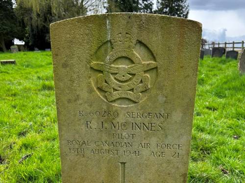
St Georges Church near Teesside Airport, Gravestone of Canadian pilot RJ McInnes aged 21 (c) Fiona Erskine
I flew from Teesside Airport to work on a project in India. While I was there, I went to visit the site of the worst industrial accident in the world. In 1984, toxic gas escaped from the Union Carbide pesticide factory in Bhopal, India, killing thousands overnight and injuring hundreds of thousands. It shocked me was to discover that the abandoned factory is still standing and has never been cleaned up.
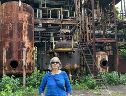
Fiona at the former Union Carbide factory in Bhopal, India in 2023
Location Map for Losing Control
I went back in 2013 and nothing had improved. I wrote Losing Control to draw attention to a terrible injustice by bringing the threat closer to home.
Thanks Fiona!
BookTrail Boarding Pass: Losing Control
Twitter: @erskine_fiona